Formation
Now a rocky tidal island, the Mont occupied dry land in prehistoric times. As sea levels rose, erosion reshaped the coastal landscape, and several outcrops of granite emerged in the bay, having resisted the wear and tear of the ocean better than the surrounding rocks. These included Lillemer, the Mont Dol, Tombelaine (the island just to the north), and Mont Tombe, later called Mont Saint-Michel. Mont-Saint-Michel consists of leucogranite which solidified from an underground intrusion of molten magma about 525 million years ago, during the Cambrian period, as one of the younger parts of the Mancellian granitic batholith. (Early studies of Mont Saint-Michel by French geologists sometimes describe the leucogranite of the Mont as "granulite", but this granitic meaning of granulite is now obsolete.) The Mont has a circumference of about 960 m (3,150 ft) and its highest point is 92 m (302 ft) above sea level
Tides
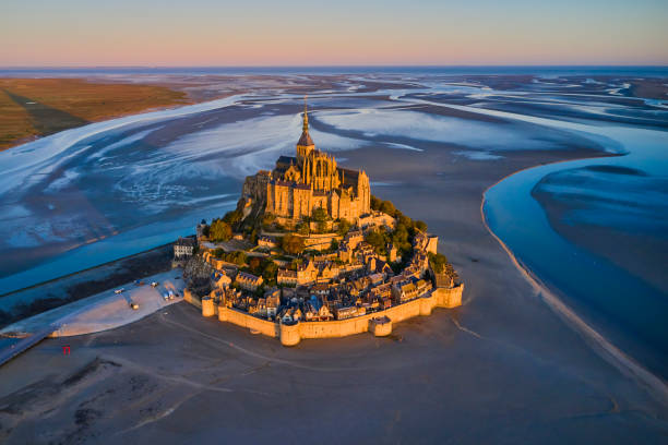
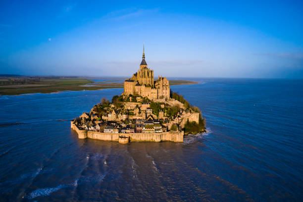
The tides vary greatly, at roughly 14 metres (46 ft) between highest and lowest water marks. Popularly nicknamed "St. Michael in peril of the sea" by medieval pilgrims making their way across the flats, the mount can still pose dangers for visitors who avoid the causeway and attempt the hazardous walk across the sands from the neighbouring coast. Polderisation and occasional flooding have created salt marsh meadows that were found to be ideally suited to grazing sheep. The well-flavoured meat that results from the diet of the sheep in the pré salé (salt meadow) makes agneau de pré-salé (salt meadow lamb), a local speciality that may be found on the menus of restaurants that depend on income from the many visitors to the mount.
Tidal island
Low tide in 2005 The Mont Saint-Michel in 2014 with the new bridge The connection between the Mont Saint-Michel and the mainland has changed over the centuries. Previously connected by a tidal causeway uncovered only at low tide, this was converted into a raised causeway in 1879, preventing the tide from scouring the silt around the mount. The coastal flats have also been polderised to create pastureland, decreasing the distance between the shore and the island, and the Couesnon River has been canalised, reducing the dispersion of the flow of water. These factors all encouraged silting-up of the bay. On 16 June 2006, the French prime minister and regional authorities announced a €200 million project (Projet Mont-Saint-Michel)[13] to build a hydraulic dam using the waters of the Couesnon and the tides to help remove the accumulated silt, and to make Mont Saint-Michel an island again. The construction of the dam began in 2009. The project also includes the removal of the causeway and its visitor car park. Since 28 April 2012, the new car park on the mainland has been located 2.5 kilometres (1.6 miles) from the island. Visitors can walk or use shuttles to cross the causeway. On 22 July 2014, the new bridge by architect Dietmar Feichtinger was opened to the public. The light bridge allows the waters to flow freely around the island and improves the efficiency of the now operational dam. The project, which cost €209 million, was officially opened by President François Hollande. On rare occasions, tidal circumstances produce an extremely high "supertide". The new bridge was completely submerged on 21 March 2015 by the highest sea level, for a once-in-18-years-occurrence, as crowds gathered to snap photos.